Amarube is known with Amarube Viaduct (余部橋梁), a railway bridge in the Kami Town, Mikata District, Hyōgo Prefecture (兵庫県美方郡香美町), on JR West's San'in Main Line between the stations of Yoroi and Amarube. There was a tragic incident involving this viaduct in the past...
On December 28, 1986, around 1:25 pm, an out-of-service Miyabi train traveling from Kasumi Station was caught by strong winds from the Sea of Japan, and all seven passenger cars of the train were blown from the bridge, with only a few bogies remaining on the tracks. The locomotive's weight prevented its derailment. The cars fell directly below, landing on a fish-processing plant. Five women working at the plant and the train's conductor died in the accident. Five others in the plant and one food-service worker aboard the train were seriously injured. This was the first disaster since the opening of the bridge. The accident is attributed to human error. Although the 25 m/s (56 mph) winds activated warning devices, the train proceeded across the bridge.
Here is a recent article I just found on Amarube Viaduct:
Photos taken during my trip
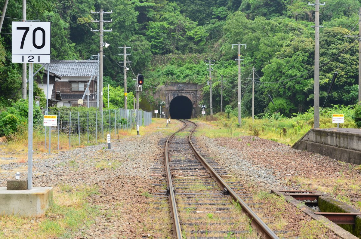
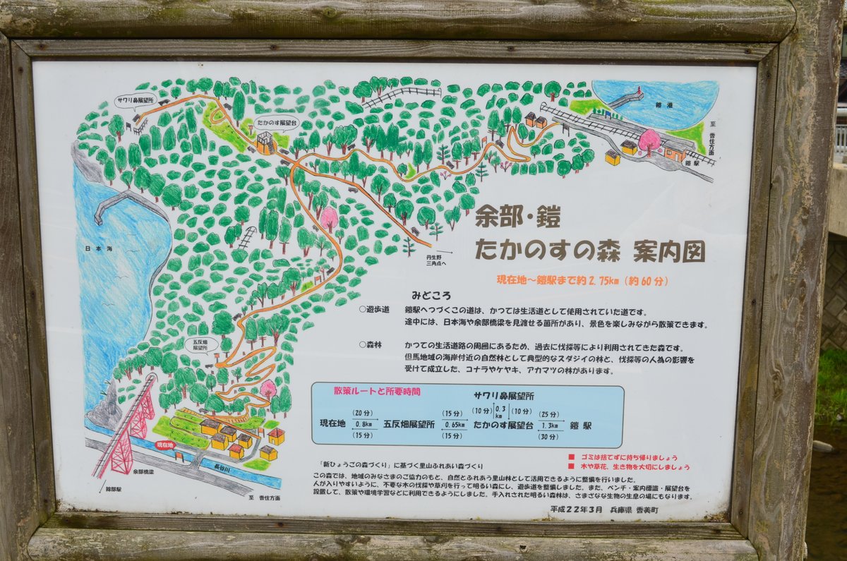
On the way from Tottori to Yoroi, the local train stopped at Igumi Station (居組駅) [10:06 am]. Igumi is the westernmost station in Hyōgo Prefecture on the San'in Main Line, also known as a "remote" station (秘境駅).The local train stopped at Amarube, but I did not get off here [10:44 am].Sea of Japan - View from the train window just after departing Amarube Station [10:44 am] The weather was not favorable…Arrived at Yoroi Station [10:48 am].The local train bound for Kinosaki-Onsen left Yoroi Station [10:48 am].Station sign of Yoroi [10:51 am]A small fishing port seen from Yoroi Station [10:55 am]A west-bound local train is approaching Yoroi Station [11:02 am].The local train (Toyooka ⇔ Hamasaka) arrived [11:02 am].The local train bound for Hamasaka is disappearing into a tunnel [11:04 am].The small station building of Yoroi Station [11:05 am]This map indicates the walking trail to the Amarube village [11:06 am].Yoroi Station [11:07 am]On the other side of three tunnels is the Amarube Viaduct [11:08 am].The map of walking trail in the Forest of Takanosu in Amarube Yoroi area [11:10 am]The first post (probably) from Yoroi Station [11:11 am]Looking at the direction of Yoroi Station, the yellow "train approaching post" (列車接近標) is barely visible below [11:34 am].1.25 Km from Yoroi Station [11:35 am]Amarube Station and the small bay of Amarube seen from the observation deck [11:37 am]Amarube Station is visible from the observation deck [11:39 am].The other side of Amarube Bay [11:39 am]Looking at the direction of Yoroi port [11:40 am]Magnifying the geological structure in Yoroi side [11:40 am] This is a part of "San'in Kaigan UNESCO Global Geopark" https://sanin-geo.jp/Halfway between Yoroi Station and Amarube Station [11:56 am]Sea of Japan [11:56 am]1.75 Km from Yoroi Station [12:01 pm]Close to the Amarube Viaduct [12:04 pm]Only 0.8 Km to Amarube Station [12:15 pm]An east-bound local train is entering into a tunnel for Yoroi. [12:23 pm].The map of the walking trail in Amarube side [12:24 pm]Roadside station (道の駅) vs. Station in the Sky (空の駅) [13:13 pm]Part of the old Amarube Viaduct remains [13:18 pm]The monument commemorating the opening of the Station in the Sky (dated 3rd of May 2013) [13:20 pm][13:25 pm]Station sign of Amarube [13:27 am]This photo was taken on 17th May after overnight stay in Amarube.
P.S. The following map suggests that construction of Kasumi (香住)-Hamasaka (浜坂) portion of San'in line in early 20th century was difficult: